High-demand
Roofing / facilities
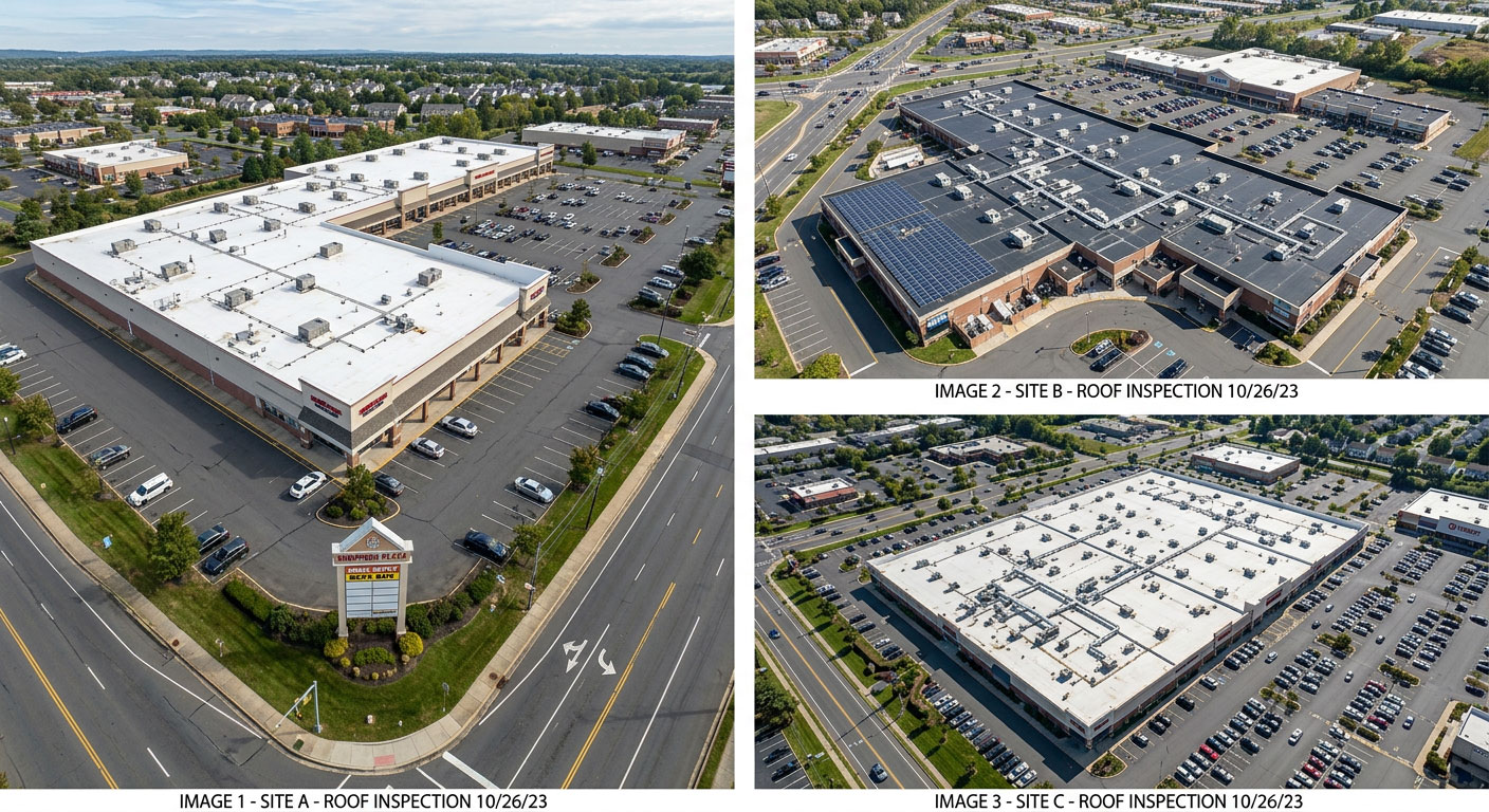
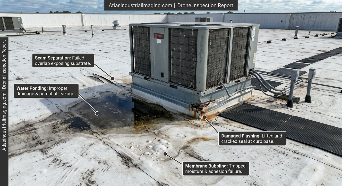
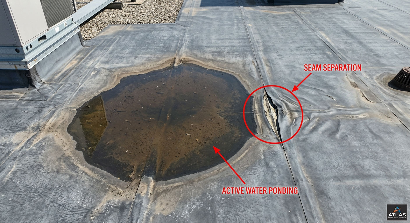
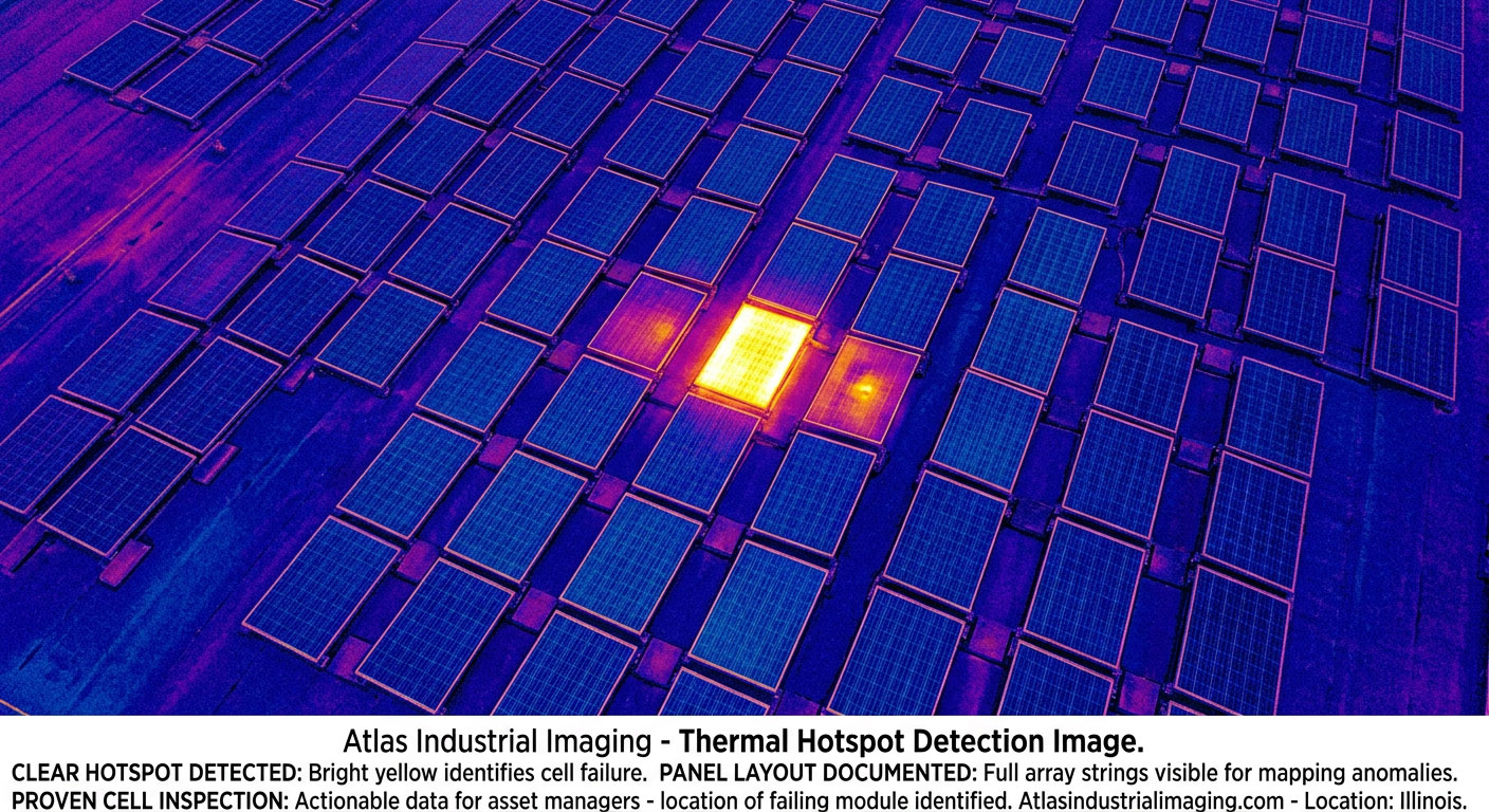
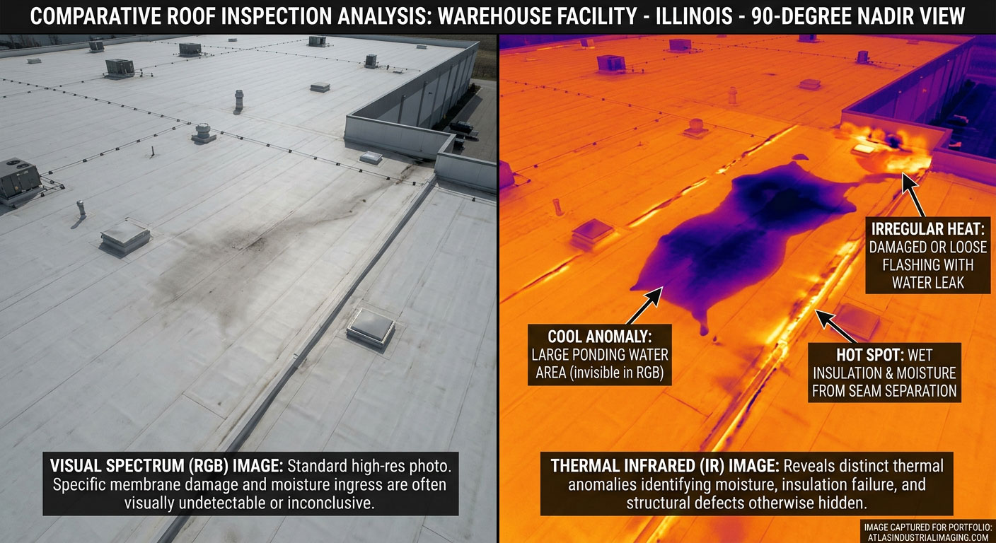
Commercial Roof Inspections
Full-building documentation for warehouses, distribution centers, and large low-slope commercial roofs. Supports pre-bid scoping, maintenance planning, and insurance workflows.