
Aerial progress documentation for active construction sites across Central Illinois
Atlas Industrial Imaging provides recurring drone-based construction progress monitoring for ground-up builds, industrial expansions, and large commercial site work. The deliverables support project owners, general contractors, and stakeholders who need consistent visual records tied to schedule milestones.
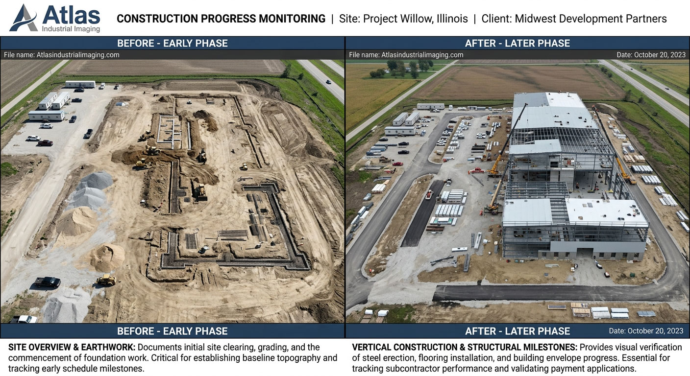
Active construction site aerial overview — milestone progress documentation
Ground-level photos don't capture the full scope of an active construction site
Large construction sites change fast. Aerial documentation gives project owners, GCs, and stakeholders a consistent bird's-eye view of site conditions, progress by zone, equipment positioning, and site organization — details that ground-level photos can't reliably capture across a large or complex site.
Full-Site Context
Aerial imagery captures the entire site in a single pass — foundation work, steel erection, site grading, material staging, and perimeter conditions all visible in relationship to each other.
Milestone-Tied Records
Flights tied to schedule milestones create a consistent visual timeline of the project — useful for internal review, lender reporting, owner updates, and any future reference needs.
Stakeholder-Ready Output
Aerial progress imagery integrates cleanly into project updates, investor presentations, owner reports, and community communication without requiring additional production work.
Construction progress monitoring serves buyers across the project delivery chain
- General contractors managing multi-phase builds
- Project owners and developers tracking progress
- Construction managers coordinating multiple subcontractors
- Industrial facility operators overseeing expansion work
- Lenders and investors requiring progress documentation
- Engineering firms with site documentation requirements
- Public entities managing infrastructure construction
- Property managers overseeing tenant improvement projects
Construction monitoring fits a wide range of active build environments
Industrial & Manufacturing Builds
New industrial facilities, manufacturing plant expansions, and warehouse construction in Central Illinois where site scale and project complexity make aerial documentation particularly valuable.
Commercial Ground-Up Construction
Retail, office, mixed-use, and large commercial builds where project owners and lenders need regular visual progress confirmation tied to draw schedules or milestone reviews.
Infrastructure & Site Development
Utility corridor work, site grading, road construction, and large-scale site preparation where aerial documentation provides the full-scope site view that ground observation cannot.
Consistent coverage of the full site at each scheduled flight
- Overall site condition and progress overview
- Foundation, structural, and framing progress by zone
- Site grading, drainage, and civil work status
- Material staging areas and equipment positions
- Perimeter conditions and site access
- Exterior cladding and roofing progress
- Parking and hardscape work
- Utility trench and infrastructure work visible from above
- Comparison to prior flight for milestone tracking
- Deliverables formatted for reports and stakeholder decks
Construction monitoring across Central Illinois
Bloomington-Normal
Primary coverage area for industrial and commercial construction sites.
Peoria / East Peoria
Construction documentation for industrial builds and commercial sites in the Peoria region.
Champaign-Urbana
Commercial and institutional construction progress monitoring.
Rivian Supplier Corridor
Industrial construction monitoring for supplier and manufacturing build-outs in the corridor.
Consistent aerial records from groundbreak to certificate of occupancy.
Atlas Industrial Imaging provides scheduled construction progress monitoring for active build sites across Central Illinois. Contact us to discuss your site, schedule, and deliverable requirements.