Aerial inspection and documentation for manufacturing plants, facilities, and industrial sites
Atlas Industrial Imaging provides FAA-certified drone-based inspection for industrial properties where ground-level observation is limited by scale, safety constraints, equipment density, or site complexity. The deliverables support maintenance planning, facility assessment, and internal reporting for operational industrial environments.
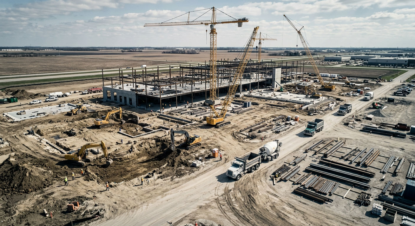
Industrial environments have documentation challenges that ground-level access alone cannot solve
Manufacturing plants, industrial facilities, and large operational sites often have roof systems, elevated structures, and large-scale surface areas that are difficult or unsafe to document from the ground. Drone inspection provides systematic aerial access without interrupting operations or requiring specialized ground access equipment.
Large-Footprint Efficiency
Industrial buildings frequently cover 100,000 to 500,000+ square feet. Drone inspection covers the full footprint in a single flight session, creating comprehensive documentation that ground-level observation cannot match at scale.
Reduced Site Exposure
Aerial documentation reduces the need for personnel to access elevated or hazardous areas during the initial condition assessment phase — before physical inspection resources are committed.
Operational Compatibility
Drone inspection can be scheduled to minimize disruption to active production environments, shift schedules, and facility operations.
Industrial inspection buyers across manufacturing and facility operations
- Manufacturing plant facility managers
- Industrial property owners and operators
- Maintenance and engineering teams
- Industrial real estate buyers and sellers
- EHS teams supporting facility documentation
- Roofing contractors working on industrial buildings
- Insurance carriers and adjusters for industrial properties
- Capital planning teams managing large facility portfolios
Drone inspection fits a range of industrial environments
Manufacturing Plants
Large industrial buildings with complex roof systems, rooftop equipment, multiple roof levels, and extensive surface area requiring systematic aerial documentation.
Distribution & Logistics Facilities
Warehouse and distribution center roof documentation, loading dock area overview, site perimeter conditions, and large-building condition records.
Industrial Yards & Operational Sites
Facility yard documentation, equipment yard overview, outdoor storage and staging area conditions, and site boundary documentation for large industrial properties.
Processing & Utility Facilities
Industrial processing sites, utility infrastructure, tank farms, and operational environments where aerial documentation supports safety planning and condition assessment.
Multi-Building Industrial Campuses
Portfolio-level aerial documentation for industrial parks and multi-building campuses where consistent records across the full property are needed for planning and reporting.
Industrial Real Estate Assessment
Pre-acquisition aerial documentation for industrial property buyers, lenders, and investors who need a current visual record of the full facility and site conditions.
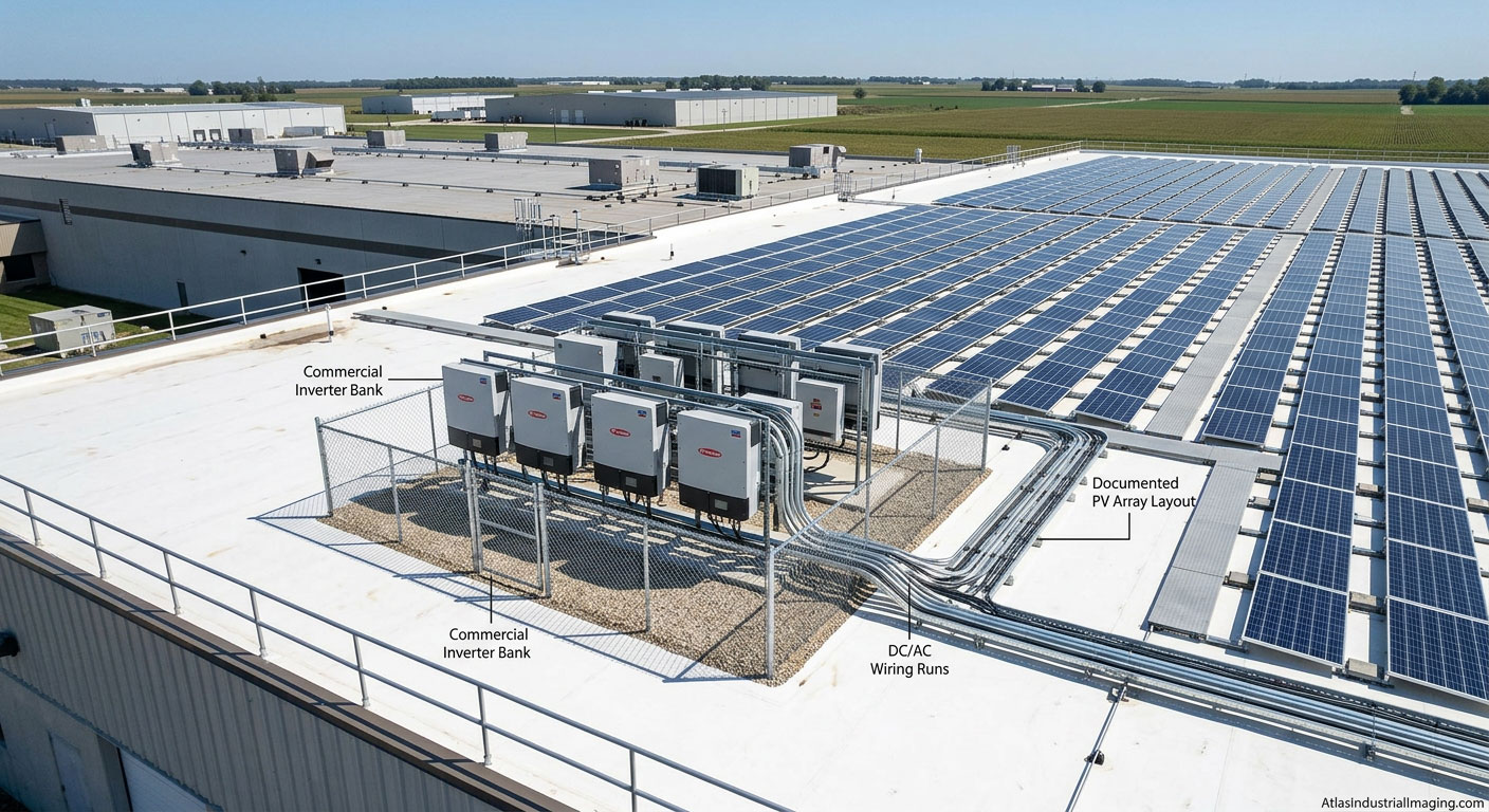
Systematic aerial coverage of the full industrial site
- Roof condition and full-building surface overview
- Rooftop equipment layout, penetrations, and access points
- Drainage systems and roof-level condition indicators
- Exterior wall and facade conditions visible from above
- Site perimeter, fencing, and access road conditions
- Yard and outdoor storage area documentation
- Loading dock and truck court overview
- Multi-building campus coverage in a single session
- Storm damage comparison and post-event documentation
- Baseline records for future condition comparison
 Equipment yard documentation
 Stack + tower aerial view
 Structure exterior documentation
 Perimeter + security overview
 Close-detail rooftop documentation
 Plant roof overview — nadir
Industrial documentation connects to multiple service lines
Commercial Roof Drone Inspections
Focused roof documentation service for commercial and industrial buildings, warehouses, and large low-slope roof systems.
Storm Damage Documentation
Post-storm aerial documentation for industrial roofs, facility structures, and large commercial properties.
Warehouse Roof Drone Inspections
Specialized page focused on large warehouse and distribution center roof documentation workflows.
Industrial drone inspection across Central Illinois
Bloomington-Normal
Industrial and manufacturing facilities in the primary service region.
Peoria / East Peoria
Manufacturing and industrial facility documentation in the Peoria market.
McLean County
County-level coverage for industrial parks and unincorporated facility sites.
I-55 Industrial Corridor
Industrial facility documentation along the I-55 corridor spine through Central Illinois.
Get full-facility aerial documentation without disrupting operations.
Atlas Industrial Imaging supports manufacturing plants, warehouses, industrial campuses, and operational facilities across Central Illinois. Contact us to discuss your site, documentation requirements, and scheduling.